
Hrabůvka between the Oderské vrchy and the Moravian Gate
Accommodation in Hrabůvka
Landscape
Hrabůvka lies at an elevation of 305 to 345 metres above sea level, below the 443-metre-high Hůrka hill and on the boundary between two geomorphological units. The northern part belongs to the Oderské vrchy subunit of the Nízký Jeseník, more specifically to the Boškovská vrchovina. The southern part belongs to the Bečevská brána subunit of the Moravian Gate, more specifically to the Jezernická pahorkatina.
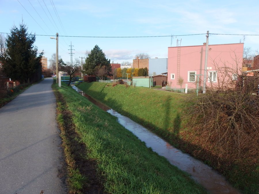
The Uhřínovský stream flows through the entire cadastral area of Hrabůvka. The elevation, hill, watercourse and divided geomorphological classification describe the place from different perspectives: as a settlement with a clearly tiered elevation, a distinctive terrain feature, its own watercourse and a position on a regional boundary.
Further destinations
History and culture
The earliest written mention of the settlement of Hrabůvka dates from 1371; at that time, the place was referred to as “William Habruowkam”. The wooden bell tower, built at the beginning of the 19th century, is one of Hrabůvka’s landmarks and stands by house number 5. A statue of Saint Florian stands in the centre of the village.
Hrabůvka thus brings together three different historical points of reference: the medieval written mention, the early-19th-century wooden bell tower and the statue in the present-day village centre. Within one kilometre of Hrabůvka, visitors will find a shopping facility and a small restaurant with an adjoining garden.
In the vicinity of Hrabůvka, on the boundary with the cadastral area of Radíkov, lies the privately owned pseudo-Gothic manor house of Kunzov. Its location on this cadastral boundary adds a building in the surrounding area to the local history, while the shopping facility and restaurant within the stated radius are separate local amenities.
Nature and leisure
During walks in the forests around Hrabůvka, visitors can collect wild berries and mushrooms. These walks also offer beautiful, far-reaching views. The Svačinka sports facility can be used for relaxation and recreational sports by arrangement with the operator.
In the vicinity of Hrabůvka, swimming is possible in a natural swimming pool in a flooded quarry in nearby Olšovec. In the Podlesí microregion, marked cycle paths lead from the Moravian Gate into the Oderské vrchy and pass through all the municipalities in the microregion. Forest walks, swimming, cycling and recreational sports represent different types of activities that can be considered separately when planning.
The descriptions of nature therefore combine several landscape areas and forms of use without presenting them as a single experience: the forests are associated with walks, the natural swimming pool with swimming, the marked paths with cycling, and the sports facility with relaxation and recreational sports by arrangement. Wild berries, mushrooms and the far-reaching views are also explicitly associated with forest walks.
For the timing and practical planning of the leisure activities, the respective details remain separate: swimming is associated with Olšovec, the cycle paths with the Podlesí microregion, and use of the sports facility with prior arrangement with the operator. This makes it possible to distinguish the different activities by their stated locations and conditions.
Transport history
The 600-millimetre-gauge narrow-gauge railway, built in 1910 and approximately three kilometres long, connected the Hrabůvka quarry with Drahotuše railway station; operations ceased in 1972 and the railway was dismantled. Its history therefore includes both the original connection between the quarry and the station and its subsequent closure and dismantling.
For the broader travel overview: Přerov District.

