
Dobrkovice – Valley, Local History and Ridges
Accommodation in Dobrkovice
Valley, Stream and Forest
Dobrkovice lies in a deep valley of the Vizovické vrchy at an elevation of 276 metres. The Holomňa stream, a tributary of the Olšava, flows through the centre of the village. Dobrkovice has preserved its agriculturally oriented character. The cadastral area included the Chlupáč forest, which covered a total of 120 hectares.
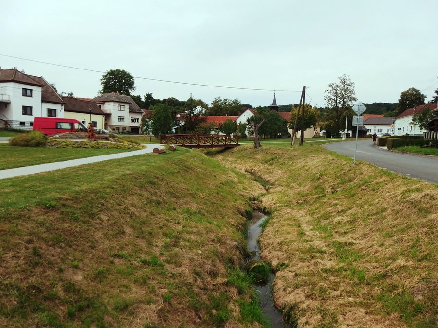
For your mental preparation, you can consider the terrain, waterways, agricultural character and forest as separate criteria. This arrangement makes the various aspects of the village visible and allows natural and cultural topics to stand alongside one another. When several interests come together, such a division helps without prematurely assigning priority to the individual aspects.
History and Sacred Sites
The oldest documented historical name of Dobrkovice is attested for the year 1360. The Baroque statue of Saint John the Baptist dates from 1744. It stands on a bare ridge above Dobrkovice at a crossroads and has been protected as a cultural monument since May 1958.
A local chapel in Dobrkovice was consecrated in 1997. The Chapel of Our Lady, Help of Christians, stands on the village square next to a bridge over the Holomňa stream. A wooden bell tower from 1832 stands on the village square in Dobrkovice; it houses a bell from 1935.
A new cross was consecrated in front of House No. 27 in 1947, on the occasion of the first Mass of Vojtěch Fuglíks, who came from Dobrkovice. The monument to those who fell in the First World War was erected in 1921. It stands above a bend near the building of the municipal office in Dobrkovice.
During a cultural tour, you can distinguish between chapels, the bell tower, the statue, the cross and the monument to those who fell. The different types of objects leave room for creating your own order without having to evaluate the stops. The historical information can also be sorted by time, object and location if you would like to keep your notes organised.
Paths and Orientation
Dobrkovice lies 1 kilometre east of the main road from Uherský Brod via Velký Ořechov to Zlín. The nearest railway station to Dobrkovice is in Biskupice.
A walk through Dobrkovice leads from the village square to the upper end of the settlement and onwards towards the ridge above the village. For your planning, you can consider the road location, railway station and local path separately, as they involve different forms of orientation.
Those who combine natural and cultural interests can note the geographical points and historical objects as two levels of organisation. A third level consists of the temporal information; together, these categories provide a clear structure for your own preparation without prescribing a fixed order.
More local pages: Horní Lhota, Doubravy, Zádverice, Ublo, Machová, Šanov, Jasenná and Slavičín.
To the higher-level travel overview: Zlín District.

