
Pleśna: Discover Cycling Routes and Landscapes
Accommodation in Pleśna
Explore Pleśna via short cycling routes, distinctive landscape features and regional destinations. This information can help you weigh up different priorities for your stay.
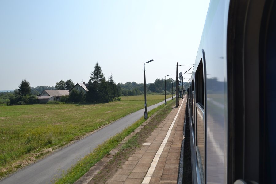 File:WK15 Łowczówek Pleśna (1) (1) Lichen99.jpg
Photo: Lichen99 via Wikimedia Commons, CC BY-SA 3.0 pl
File:WK15 Łowczówek Pleśna (1) (1) Lichen99.jpg
Photo: Lichen99 via Wikimedia Commons, CC BY-SA 3.0 pl
Pleśna at a glance
- The “BATYLOWA” cycling route is 1.5 km long and runs from Pleśna Market via Pleśna-Batylowa and back to the market.
- “GONDÓWKA” is 4 km long; it runs from Pleśna Cemetery via Pleśna-Gondówka to Pleśna-Równie.
- At 523 m, Wał is the highest elevation in the municipality of Pleśna.
- The wooden observation tower in Dąbrówka Szczepanowska is 16 m high and has five levels with viewing terraces.
- Fossils discovered in the Lichwin quarry have been dated to around 66 million years ago.
Which cycling route suits your plans?
The two routes differ first of all in length and course. At 1.5 km, “BATYLOWA” is the shorter route. Since it starts and ends at the market, the market is both its starting point and endpoint. The 4 km “GONDÓWKA” starts at Pleśna Cemetery and runs via Pleśna-Gondówka to Pleśna-Równie. It therefore ends at a different named location from its starting point.
“GONDÓWKA” is also described as running through varied, hilly terrain, mostly on paved roads. At the highest point of the route, there is a viewpoint overlooking Pleśna. So when weighing up the two routes, you can compare their stated lengths and courses, and—in the case of “GONDÓWKA”—the information about terrain, surface and views.
Where can you see the landscape and geological history?
Wał is one of the peaks of the Pogórze Rożnowskie and also the highest elevation in the municipality of Pleśna. As a landscape-focused option, you can compare this distinctive high point with the views of Pleśna along the routes. From Gródek, you can see, among other things, the landscape of the Pogórze Ciężkowickie and peaks of the Beskidy Niskie and Sądeckie.
The Lichwin quarry is also associated with a distinctive natural history: fossils, including petrified tree trunks, were discovered during the extraction of raw materials. The finds have been dated to around 66 million years ago; the origin of the petrified trunks is uncertain. In the municipality, landscape views and geological discoveries therefore offer two different topics.
Another distinctive structure is the wooden observation tower in Dąbrówka Szczepanowska. Its height of 16 m and five levels with viewing terraces give a clear impression of its design. Before visiting, check current access arrangements if access is important to your plans.
What other experiences can you plan for?
A local hiking trail marked with blue and yellow dots leads to Diabli Kamień. It starts at the “Chata pod Wałem” agritourism farm. Check the current condition of the trail before setting out.
At the RELAKS Sports and Recreation Centre in Łowczówek, possible activities include playing ball games, exercising and walking. What is available may change, so check in advance whether your preferred activity is suitable for your visit. The Centrum Produktu Lokalnego offers a variety of event formats, including workshops, seminars, training sessions, courses, conferences, tastings and exhibitions. If you have a particular format in mind, check the date and access arrangements in advance.
In Janowice, the 19th-century palace in the English Neo-Gothic style is another architectural point of interest. If you plan to visit, check current visiting arrangements beforehand.
Discover more destinations: Zbylitowska Góra, Ołpiny, Skrzyszów, Jamna, Ryglice, Siedliska, Tuchów and Zakliczyn.
FAQ
How do the two cycling routes differ?
“BATYLOWA” is 1.5 km long and runs from Pleśna Market via Pleśna-Batylowa and back to the market. “GONDÓWKA” is 4 km long and runs from Pleśna Cemetery via Pleśna-Gondówka to Pleśna-Równie.
What is known about the terrain and views along the “GONDÓWKA” route?
The route runs through varied, hilly terrain and mostly along paved roads. At its highest point, there is a viewpoint overlooking Pleśna.
What nature-related features can you find in the municipality of Pleśna?
At 523 m, Wał is the highest elevation in the municipality. Fossils, including petrified tree trunks, were discovered in the Lichwin quarry and have been dated to around 66 million years ago; their origin is uncertain.
For the broader travel overview: Tarnów.

_(1)_Lichen99.jpg)