
Radków
Accommodation in Radków
Radków offers three distinct starting points for planning a trip: buildings with different architectural influences, a named road connection and a described circular trail. When choosing your destination, you can therefore consider whether culture, the road route or hiking will shape your plans. The information about the church, town hall and hiking trail provides specific themes, while the road description also places Radków on a route connecting it with Kudowa.
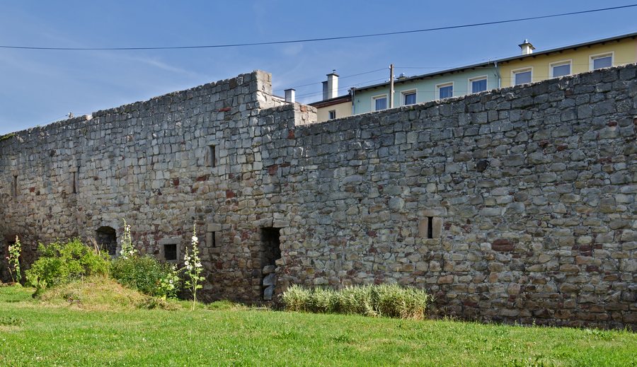
Radków at a glance
- St. Dorothy’s Church is Late Gothic and was remodelled in the mature Baroque style.
- The Renaissance town hall dates from 1545; several rooms with groin vaults have been preserved on the ground floor.
- A circular trail starts in Radków on the blue hiking trail and leads via Radkowskie Skały and Słoneczne Skały before returning.
- The mountain road Szosa Stu Zakrętów, also called Droga Stu Zakrętów, connects Radków with Kudowa via Karłów and the Lisią Pass.
Which buildings shape the cultural side of Radków?
Two architectural influences are part of the description of St. Dorothy’s Church: it is a Late Gothic church that was remodelled in the mature Baroque style. Its classification therefore involves more than a single architectural style. The Late Gothic character and the Baroque remodelling describe different aspects of the same building.
The town hall offers more than a year as a point of reference. It dates from 1545 and is described as a Renaissance town hall. Despite extensive alterations, several rooms with groin vaults have been preserved on the ground floor. If you are interested in architectural forms, you can consider these details together: the date and Renaissance classification describe the town hall as a whole, while the preserved vaulted rooms identify a specific feature on the ground floor. Along with St. Dorothy’s Church, they make up a clearly defined cultural theme for Radków.
What hike and landscape are described?
The Radków–Radkowskie Skały–Słoneczne Skały–Radków circular trail starts in Radków on the blue hiking trail. Its name makes the sequence of places clear: Radków is both the starting point and the endpoint, with Radkowskie Skały and Słoneczne Skały in between. If hiking is a focus of your trip, this is the specific circular route described for Radków.
Another description of the hiking trail mentions the rock faces of Baszta, which the trail passes between. Baszta is one of the rock formations of Radkowskie Skały. This identifies a specific landscape feature, not just a destination by name. To decide what interests you, you can compare the cultural attractions with the references to rock formations and hiking trails. The descriptions cover different themes; they do not specify a day-trip itinerary or establish a connection between the trail sections mentioned.
How is Radków connected by road?
The mountain road Szosa Stu Zakrętów is a section of provincial road 387. Also called Droga Stu Zakrętów, it connects Radków with Kudowa via Karłów and the Lisią Pass. The highest point of the Lisią Pass is above 780 m. These place and elevation details give the road connection a specific geographic reference without stating a travel time. If you are considering Radków in relation to Kudowa, you can take this named route into account when planning your trip.
This lets you compare the destination based on specific interests rather than infer particular features or a location from an accommodation.
More destinations to compare: Bystrzyca Kłodzka, Kłodzko, Ołdrzychowice Kłodzkie, Jodlow, Kąty Bystrzyckie, Raszków, Kudowa-Zdrój, Lewin Kłodzki.
FAQ
What year does the Radków town hall date from?
The Renaissance town hall in Radków dates from 1545.
What is known about St. Dorothy’s Church?
It is a Late Gothic church that was remodelled in the mature Baroque style.
Where does the circular trail via Radkowskie Skały start?
The circular trail starts in Radków on the blue hiking trail and leads via Radkowskie Skały and Słoneczne Skały before returning to Radków.
Which places does the mountain road connect?
The road connects Radków with Kudowa via Karłów and the Lisią Pass. The highest point of the pass is above 780 m.
For the broader travel overview: Kłodzki.

