
Pianu De Jos: Golf, Church and Archaeology
Accommodation in Pianu De Jos
In Pianu de Jos, the specific destinations range from the “Paul Tomiță” golf course and the “Adormirea Maicii Domnului” Orthodox Church to the “Podei” archaeological site. These places are complemented by Dealul Pleşilor Mountain, further elevations in the surrounding region and a tourist trail to Vârful Muncelu.
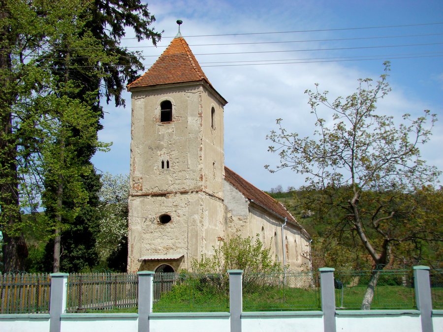 File:Biserica evanghelică din Pianu de Jos (2).jpg
Photo: Țetcu Mircea Rareș via Wikimedia Commons, CC BY-SA 4.0
File:Biserica evanghelică din Pianu de Jos (2).jpg
Photo: Țetcu Mircea Rareș via Wikimedia Commons, CC BY-SA 4.0
Golf and Church
The “Paul Tomiță” golf course was founded in 1995 by Paul Tomiță with the support of Prince Sturza. Its history therefore includes not only the name of the course, but also a named initiator, a supporter and a specific founding year. The current opening hours should be checked before visiting a golf facility.
The “Adormirea Maicii Domnului” Orthodox Church in Pianu de Jos is traditionally dated to the beginning of the 18th century. Its walls contain materials from Roman buildings. The church thus combines a traditional dating with visibly preserved structural elements from older buildings, without the two historical layers belonging to the same period.
Podei Archaeological Site
The “Podei” archaeological site in Pianu de Jos contains several settlement layers. They are attributed to the Turdaș, Petrești and Coțofeni cultures. Finds include flint blades and polished stone axes. Alongside the settlement layers from different periods, specific stone tools are therefore also central to the site. Visitors interested in culture will find an independent historical focus here, distinct from the church’s sacred architectural history.
Landscape Destinations
Dealul Pleşilor Mountain is located in the vicinity of Pianu de Jos. In the broader surrounding region are also Dealul Pleşeioara Mountain and Măgura Rodului Mountain, as well as Dealul Draşovului Hill. The three destinations mentioned last are thus referred to as mountains or as a hill. This distinction is practical when planning landscape destinations because a mountain and a hill have different destination designations, while their geographical relationship to Pianu de Jos remains in each case within the broader surrounding region.
Tourist Trail and Panoramic Platforms
An approximately 36-kilometre-long tourist trail leads from Pianu de Jos to Vârful Muncelu in the Cărări area. The route is expressly specified only with an approximate length. Two panoramic platforms were built along this trail on the hill of Pianu de Jos. At night, they are illuminated with LED systems powered by solar panels. The trail, hill and platforms thus form part of a described, interconnected destination area, without the approximate route length being interpreted as an exact distance.
For a route given with an approximate length, current trail conditions should be checked before setting out. Checking the current opening hours is likewise part of the usual preparation for using the golf facility. Brăzești, Șugag, Blaj, Mesentea, Arieşeni, Poiana Aiudului, Laz and Albac are further destinations.
For the higher-level travel overview: Alba.

.jpg)