
Discover Baciu
Accommodation in Baciu
Baciu’s geographical profile includes an archaeological site at Glavacioc, the Puturosu stream, woodland, and the parish church. The information varies in the place or scale it refers to; historical transport references should also be understood in their historical context. This makes it possible to consider landscape features and practical information about the village separately.
Baciu quick facts
- The Baciu archaeological site – BLE 003 is on the western terrace of the Glavacioc, west of the Cotorani neighborhood.
- The Puturosu stream flows into the Glavacioc below the village of Baciu.
- In the northern part of the municipality, larger forested areas lie between Sericu and Baciu, on both sides of the Glavacioc.
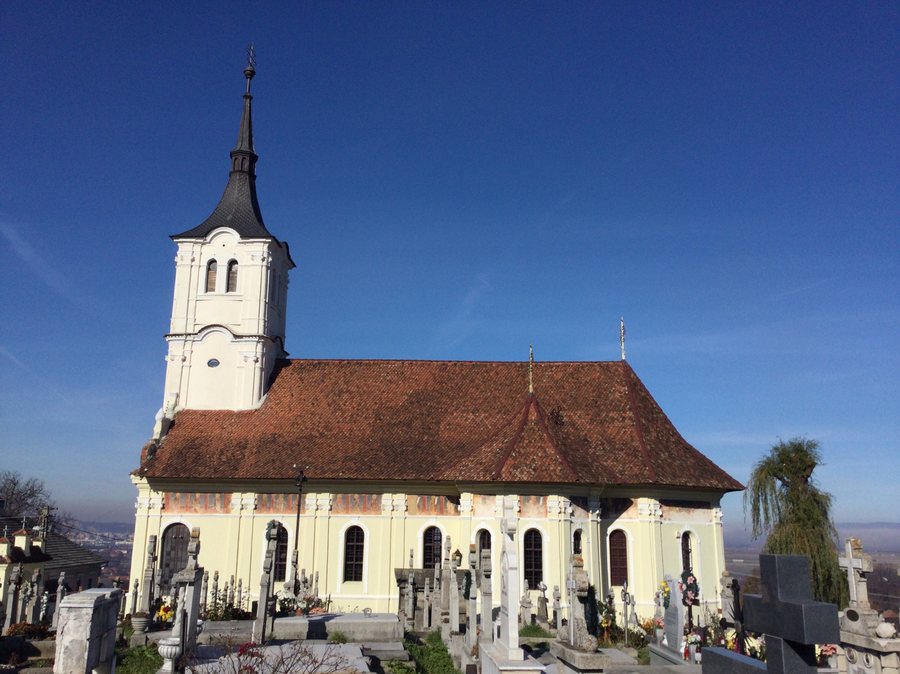
- The parish church of Baciu is dedicated to Saint John the Baptist, “Sf. Ioan Botezătorul.”
- A historical description places Baciu on a county road connecting Videle, Blejești, Purani, and Poieni.
- A historical directory lists stops on DJ 503 in the Poştă neighborhood and on Strada Cotorani.
Where is the site located?
Two directional references are given for the Baciu archaeological site – BLE 003: it is on the western terrace of the Glavacioc and west of the Cotorani neighborhood. Taken together, these references relate the site to the river and a named neighborhood. They help locate the site within Baciu, rather than equating its location with a description of the entire municipality. The name BLE 003 is also part of the site’s name and can be used alongside Baciu when referring to this specific place.
How are the stream, river, and forested areas connected?
The Puturosu flows into the Glavacioc below the village. The information about the forests refers to a different scale: it concerns the northern part of the municipality, the area between Sericu and Baciu, and both sides of the Glavacioc. Thus, a specific confluence and a broader forested zone are described side by side. If you are interested in Baciu’s landscape, you can distinguish between these references: the stream identifies a point, while the forests characterize an area between two villages and on both sides of the river.
What cultural landmark is mentioned?
The parish church of Baciu is dedicated to Saint John the Baptist. “Sf. Ioan Botezătorul” is the Romanian name given alongside the English one. This dedication provides a specific cultural reference within the information about the village, separate from the details about the site and the landscape. The dedication itself is the key reference for identifying the church: it names the saint to whom the church is dedicated.
What is known about the road and public transport?
A historical description places Baciu on the county road connecting Videle, Blejești, Purani, and Poieni. This reference places the village on a road between the named locations. The stops listed for Baciu in a historical directory are separate: one on DJ 503 in the Poştă neighborhood, and another on Strada Cotorani. The place names provide two specific references, but no current timetable. Before your trip, check current public transport options if you plan to travel by bus or another form of public transit.
Discover more destinations: Turnu Măgurele, Fântânele, Videle, Islaz, Bogdana, Mariţa, Stefan-Cel-Mare, Alexandria.
FAQ
Where is the Baciu archaeological site – BLE 003?
It is on the western terrace of the Glavacioc and west of the Cotorani neighborhood.
Who is the parish church of Baciu dedicated to?
Saint John the Baptist, called “Sf. Ioan Botezătorul” in Romanian.
Which stops are listed for Baciu?
A historical directory lists one stop on DJ 503 in the Poştă neighborhood and another on Strada Cotorani. Check current public transport before your trip.
Go to the regional travel overview: Teleorman.

