
Discover Donovaly: Nature, Trails and Experiences
Accommodation in Donovaly
Donovaly combines mountain landscapes, winter sports, cycling options and cultural destinations.
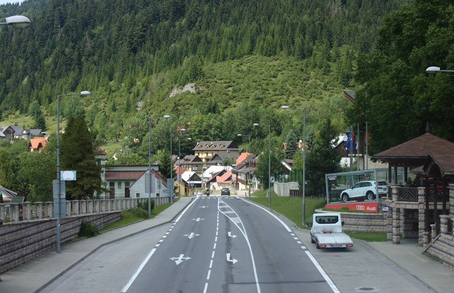 File:Donovaly, silnice.jpg
Photo: I would appreciate being notified if you use my work outside Wikimedia. More of my work can be found in my personal gallery . via Source, CC BY-SA 4.0
File:Donovaly, silnice.jpg
Photo: I would appreciate being notified if you use my work outside Wikimedia. More of my work can be found in my personal gallery . via Source, CC BY-SA 4.0
What characterizes the landscape around Donovaly?
Donovaly lies in an expansive mountain saddle at about 960 meters above sea level. The area around Donovaly extends into the Low Tatras National Park.
The Donovaly–Šachtička educational trail is 11.5 kilometers long.
What winter sports opportunities are available?
PARK SNOW Donovaly offers groomed ski slopes. Modern cable cars are available for winter sports at PARK SNOW Donovaly.
How extensive is the cycling offering?
The Riders Park Donovaly includes flow trails for beginners. The Riders Park Donovaly also includes advanced trails with jumps, berms and technical sections.
The cycling routes in Donovaly range from shorter loops to full-day mountain tours.
The four-seat Buly Expres cable car takes bicycles directly to the trailheads in the Riders Park.
What experiences complement nature and sports?
In addition to ski slopes and cycling routes, Donovaly has a 14-meter-high climbing wall next to the parking lot of the cable car to Nová hoľa.
The summer toboggan run in Donovaly is just under 900 meters long and has seven jumps.
Habakuky consists of houses in the style of folk fantasy architecture. There, visitors can immerse themselves in the Slovak folk tales of Pavol Dobšinský.
What culture and history can you discover in Donovaly?
The Church of St. Anthony of Padua dates from 1825. Inside, there is a Classicist altar with a painting of Saint Anthony by the Banská Bystrica painter A. Stollman.
There are three chapels in Donovaly, in the settlements of Bully, Mistríky and Polianka.
Donovaly developed from seven charcoal burners' settlements belonging to the Banská Chamber.
How can you find your way around locally?
The Donovaly mobile guide provides multilingual text, image and, above all, audio information about tourist attractions. After the information has been downloaded in advance, the Donovaly mobile guide also works without GSM or mobile data coverage.
FAQ
How long is the Donovaly–Šachtička educational trail?
Where is the climbing wall in Donovaly located?
The 14-meter-high climbing wall is located next to the parking lot of the cable car to Nová hoľa.
What are the dimensions of the summer toboggan run?
It is just under 900 meters long and has seven jumps.
What can you expect at Habakuky?
Habakuky consists of houses in the style of folk fantasy architecture and lets visitors immerse themselves in the Slovak folk tales of Pavol Dobšinský.
Does the mobile guide work without network coverage?
Yes. After the information has been downloaded in advance, the mobile guide also works without GSM or mobile data coverage. It provides multilingual text, image and, above all, audio information about tourist attractions.
Which settlements have chapels?
To the overarching travel overview: Banská Bystrica District.

