
Chudíř between History and Nature
Accommodation in Chudíř
Chudíř between Fields and Forests
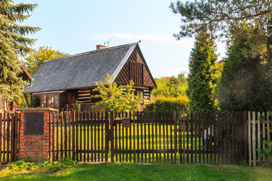
Chudíř lies on a gentle slope between fertile fields to the west and deep forests to the east. Its location reveals two different landscape areas: the open fields and the enclosed forest. The contrast between the fields and the forest shapes the first spatial impression of Chudíř. This combination of different, clearly defined landscape and historical points continues in the village and its surroundings.
Historical Points of Reference
Chudíř is first mentioned in writing in 1318. From 1555 onward, Chudíř belonged to the Dobrovice estate. Chudíř is also the birthplace of Dalibor Pokorný. The dates and biography give the village's history several temporal and personal points of reference. The affiliation with the Dobrovice estate represents a later historical reference than the first written mention in 1318. The village can thus be viewed both through its early written mention and through its later affiliation with the Dobrovice estate and its connection to a specific person.
Landmarks in the Village
A stone cross with a pedestal stands in the center of Chudíř. In the southern part of Chudíř, there is a chapel dedicated to the Virgin Mary that is of interest from a heritage conservation perspective. The chapel is not listed in the register of immovable monuments. At the former site of the bell tower „U Zvoneckých“ stood a village bell dated 1776; today, a cross stands there. The cross, chapel, and former bell tower site represent different elements of the village landscape: present-day religious landmarks, the memory of a historic bell, and a building dedicated to the Virgin Mary. The cross and chapel are located in different places: the cross in the center and the chapel in the southern part of Chudíř.
Loučeňské rybníčky and Valuable Wetlands
The Loučeňské rybníčky area around Chudíř comprises hard-water habitats with oligo- to mesotrophic characteristics and stonewort vegetation, as well as base-rich fens. The pond shores contain highly valuable calcareous fens with numerous endangered plant species. These water and wetland areas belong to the surroundings of Chudíř and complement the village center with a clearly defined natural area. The pond shores provide the specific spatial link to the calcareous fens and the endangered plant species found there.
Educational Trail and Cycling Route
Information is provided along the Loučeňské rybníčky educational trail with the help of information boards. On its return route to Loučeň, the Loučeňsko cycling route passes through Chudíř along traffic-free side roads. The educational trail focuses on Loučeňské rybníčky, while the cycling route incorporates Chudíř into its route to Loučeň. For travel planning, this provides two clearly defined ways to explore the surroundings: information along an educational trail and a cycling route whose return leg passes through the village along traffic-free side roads. On the cycling route, Chudíř appears as part of the return journey to Loučeň; the traffic-free side roads are explicitly part of the described route. The educational trail, by contrast, relates directly to Loučeňské rybníčky and its information boards. The two routes therefore lead to different focal points within the surroundings of Chudíř.
Other Places
Other places: Brodce, Dobsin, Kobylnice, Charvatce, Neveklovice, Pětikozly, Josefuv Dul, Plazy
To the main travel overview: Mladá Boleslav District.

