
Heřmanovice: Hotels and Accommodation
Accommodation in Heřmanovice
Heřmanovice has protected village architecture featuring single-storey log houses of the East Sudeten type, steep gabled roofs and stone foundations.
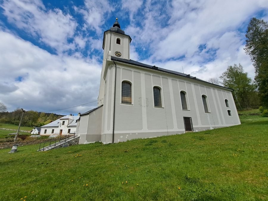 File:Heřmanovice, kostel sv. Ondřeje 03.jpg
Photo: Mikuláš Galuszka via Wikimedia Commons, CC BY-SA 4.0
File:Heřmanovice, kostel sv. Ondřeje 03.jpg
Photo: Mikuláš Galuszka via Wikimedia Commons, CC BY-SA 4.0
Culture
In the centre of Heřmanovice, the parish church of Saint Andrew stands on a slope. It was built in 1588, remodelled and extended in the Baroque style in 1739, and reconsecrated in 1766. Its furnishings include a late Renaissance stone baptismal font with colourful reliefs of Saint Andrew and scenes from the life of Christ. The church is surrounded by a wall with an original gate around the former cemetery.
Above the limestone quarry stands the chapel of Saint Jerome. Following restoration, it was reconsecrated on 28 September 1997.
Mining History
Vysoká pec Drakov preserves the remains of a charcoal furnace dating from 1807. The surviving stone structure measures 15 × 8 metres and ends in a barrel vault on one side; opposite are the remains of a water channel.
Důl Žebračka is a mining heritage complex consisting of spoil heaps, adits and shafts on the eastern slope of Příčný vrch near the road to Zlaté Hory. Důl Karel is a medieval mine on the plateau of Příčný vrch in the Hackelsberg mining district, in the cadastral areas of Heřmanovice and Horní Údolí. It comprises a 60-metre-long adit, a hand-hewn 40-metre-long shaft and two blind shafts with wooden pipework.
Nature and Landscape
The Heřmanovice Site of Community Importance protects the Carpathian newt (Triturus montandoni) and covers 18.6922 hectares. The site lies approximately 600 metres west of the northern edge of Heřmanovice and is one of the three most important occurrences of the Carpathian newt in the Sudeten region.
The Opavice forms the axis of Heřmanovice and flows in a south-easterly direction. It rises above the northern end of the village on the south-western slope of Příčný vrch, located in the vicinity of Heřmanovice, at an elevation of 850 metres. Its length within the cadastral area is 35.7 kilometres; the long-term flow rate measured in Heřmanovice is 0.23 m³/s.
Příčný vrch is located in the vicinity of Heřmanovice. The mountains Zámecký vrch, Zámecký pahorek and Ďablův Kopec are also located around Heřmanovice. The marked cycling routes around Heřmanovice include the Opavice Czech-Polish border route, which can be used there for cycling trips.
Culture in the Surrounding Area
The ruins of Edelštejn are located in the vicinity of Heřmanovice. The ruins of Cvilin and Studánka Church are located in the wider regional area.
Other Locality Pages
Other locality pages: Václavov U Bruntálu, Mezina, Krnov, Moravskoslezský Kočov, Slezské Pavlovice, Úvalno, Hlinka, Ryžoviště.
For the higher-level travel overview: Bruntál District.

