
Mezholezy: Hotels and Accommodation
Accommodation in Mezholezy
Mezholezy is framed by the wooded slopes of the Sedmihoří hills. The landscape includes geological features as well as several hills and a nearby body of water.
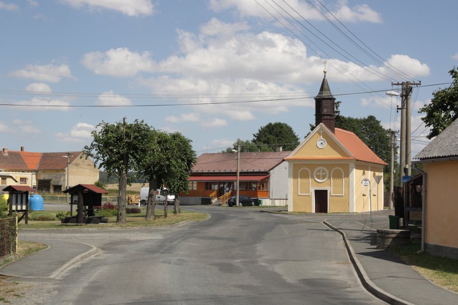 File:Mezholezy (dříve okres Horšovský Týn) - náves od JZ.jpg
Photo: RomanM82 via Wikimedia Commons, CC BY-SA 4.0
File:Mezholezy (dříve okres Horšovský Týn) - náves od JZ.jpg
Photo: RomanM82 via Wikimedia Commons, CC BY-SA 4.0
Landscape and Geology
The Sedmihorský peň geological area includes the cadastral territory of Mezholezy u Horšovského Týna. The Sedmihorský peň geological site is freely accessible; by car, it can be reached to within 250 metres.
The hills of Vinice (Mezholezy u Horšovského Týna), Malý Křakovský vrch (Mířkov), Sedmihoří and Křakovský vrch (Mířkov) are located in the vicinity of Mezholezy.
Water
Mezholezský rybník is located near Mezholezy and covers 38 hectares. Originally, it was fed by streams from the mountains and served as an important water feature. Swimming and limited recreational use are possible at the water body.
Culture and History
The façade details of the farmhouses in Mezholezy include the initials of former owners as well as window surrounds with diamond and envelope decoration.
A Baroque wayside shrine stands by the road on the opposite side of Mezholezy village square. The Neo-Gothic Chapel of the Exaltation of the Holy Cross, Pozdvišení sv. Kříže, also stands on the village square. It is mentioned in the village as early as the 18th century and was reconsecrated in 1895.
More Local Pages
Chodov U Domažlic, Tlumačov, Pelechy, Spáňov, Vlkanov, Úsilov, Libkov, Milavče
For the higher-level travel overview: Domažlice District.

_-_n%C3%A1ves_od_JZ.jpg)