
Úsilov: Hotels and accommodations
Accommodation in Úsilov
Úsilov has preserved its original village architecture and character.
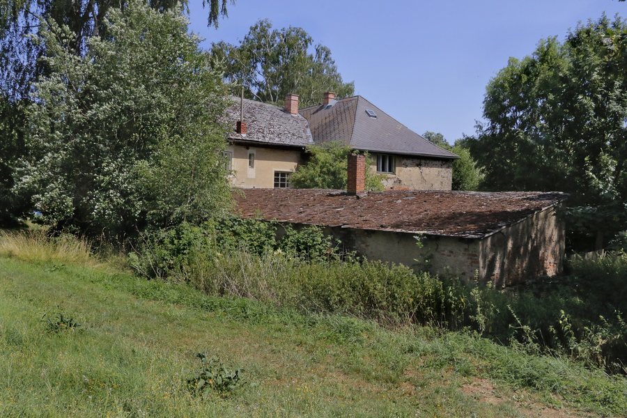 File:Úsilov Fortress III.jpg
Photo: Pavel Hrdlička (Czech Wikipedia user Packa ) via Wikimedia Commons, CC BY-SA 4.0
File:Úsilov Fortress III.jpg
Photo: Pavel Hrdlička (Czech Wikipedia user Packa ) via Wikimedia Commons, CC BY-SA 4.0
Landscape and village character
The village lies in a wide basin surrounded by the wooded hills of the Chudenická vrchovina and Švihovská vrchovina. The Dubovka stream flows through Úsilov. The larger of the two ponds built on the Dubovka is called Mlýnský rybník.
History
The earliest written mention of Úsilov dates from 1379. In the late 14th century, Úsilov belonged to Švihov Castle. Drawings from the late 17th century show the Úsilov fortress under the names “Ausylow” and “Twrz Ausylow”.
The original Úsilov fortress was probably built in the second half of the 14th century. Its oldest part is a tower-like building whose original form was altered by its conversion into a granary. A square tower and a short Renaissance wing were added to the fortress later. The fortress was once surrounded by a moat, but no remains of it have survived. The last major alterations to Úsilov fortress took place in 1930.
Hiking and cycling
A green-marked hiking trail runs through Úsilov. Another hiking trail also crosses the village from east to west. In the surrounding area, a hiking trail leads through forests up to Mount Koráb, with an observation tower and restaurant.
Cycle Route 2192 runs through the northeastern part of the Úsilov municipal area and through the village. Cycle Route 2193 leads through wooded areas in the western part of the Úsilov municipal area.
Public transport to Úsilov is provided by bus services.
More pages about localities
More pages about localities: Chodská Lhota, Nemanice, Mrákov, Capartice, Hostouň, Úboč, Meclov, Ceska Kubice.
To the higher-level travel overview: Domažlice District.

