
Kimle: River Landscape and Local History
Accommodation in Kimle
Kimle lies in an eight-kilometre loop of the Mosoni-Duna and combines a distinctive river landscape with church and local history. The named places range from the chestnut avenue in Horvátkimle to the historic Sarlós Boldogasszony Church in Magyarkimle and the newly built Apor Vilmos Church in Novákpuszta.
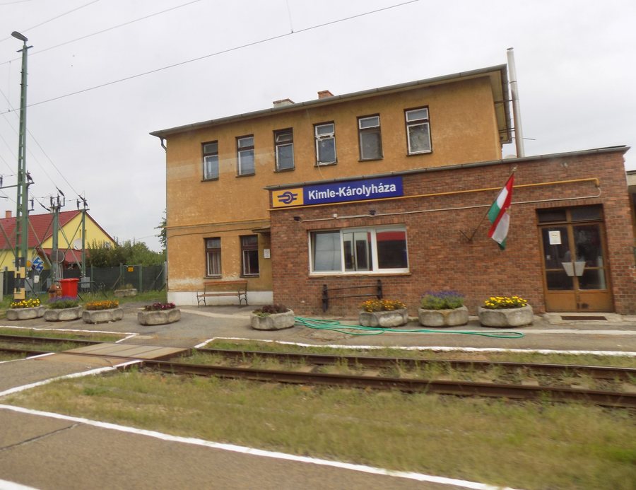
Kimle at a glance
Hanság and Szigetköz meet near Kimle. Kimle was formed in 1966 by the merger of Horvátkimle, Magyarkimle and Novákpuszta, which coincided with the opening of a new bridge.
The named churches include the Szent Mihály Church in Horvátkimle, the Sarlós Boldogasszony Church in Magyarkimle and the Apor Vilmos Church in Novákpuszta. The faluház houses a statue of Béla IV; a lime tree described as 130 years old stands beside a Szentháromság statue.
What do the churches reveal about Kimle’s history?
The Szent Mihály Church in Horvátkimle took its present form in 1780. Gothic details in the choir point to an earlier origin. The church thus brings together a specific date for its present form and clues to an older building history.
In Magyarkimle, the Sarlós Boldogasszony Church stands on the site of a church that existed as early as the 13th century. The two churches therefore offer different historical points of reference: 1780 for the present form of the Szent Mihály Church and the 13th century for the earlier church on the Magyarkimle site.
Which local landmarks are named?
The chestnut avenue A hősök útja runs in Horvátkimle from the Szent Mihály Church to the cemetery gate. Its name and two endpoints give this landmark a clear local setting.
A lime tree described as 130 years old stands beside a Szentháromság statue. The faluház houses a statue of Béla IV. The newly built Apor Vilmos Church in Novákpuszta is also listed as a sight. Together, these places represent different local points of reference: an avenue, a statue and churches at precisely named locations.
How can Kimle’s landscape be understood?
The eight-kilometre loop of the Mosoni-Duna defines Kimle’s geographical setting; Hanság and Szigetköz also meet near Kimle. This landscape perspective differs from the local building and commemorative histories. For an initial overview of Kimle, two themes can therefore be distinguished: its riverside setting and the history reflected in its churches and other named places.
What other themes are part of the Raab-Wieselburg-Ödenburg travel destination?
The cultural and natural themes of the broader Raab-Wieselburg-Ödenburg travel destination extend beyond Kimle’s local history. The Benedictine monastery in Pannonhalma was founded in 996. The UNESCO World Heritage property of the Archabbey and its natural environment includes the monastery complex, basilica, educational buildings, the Chapel of Our Lady, the Millennium Chapel, and botanical and herb gardens.
The Fertő/Neusiedler See cultural landscape is also part of this broader travel destination. It encompasses Eurasia’s westernmost steppe lake, as well as wetlands, saline soils, reed beds and shore areas. Lake Neusiedl forms the core of Fertő-Hanság National Park; the Hungarian part has been protected since 1977. Thus, alongside Kimle’s riverside setting and local history, the Raab-Wieselburg-Ödenburg travel destination also features monastic heritage and a diverse lake landscape as distinct themes.
Discover more destinations: Jánossomorja, Hegyeshalom, Lipót, Levél, Halászi, Dunakiliti, Dunakiliti-Tejfalusziget, Mosonmagyaróvár.
FAQ
How was Kimle formed?
Kimle was formed in 1966 by the merger of Horvátkimle, Magyarkimle and Novákpuszta, at the same time as a new bridge opened.
What historical details does the Szent Mihály Church feature?
It took its present form in 1780. Gothic details in the choir point to its earlier origin.
What is A hősök útja?
It is a chestnut avenue in Horvátkimle that runs from the Szent Mihály Church to the cemetery gate.
Which landscape features are mentioned for Kimle?
Kimle lies in an eight-kilometre loop of the Mosoni-Duna; Hanság and Szigetköz meet near Kimle.
For the broader travel overview: Mosonmagyaróvári.

