
Discover Tarnawa Dolna
Accommodation in Tarnawa Dolna
Tarnawa Dolna lies on the Kalniczka and is also part of a local history that first describes a single settlement shared with Tarnawa Górna. For planning your trip, the changing place names and the “Wzgórze Gruszka” cycling route, which passes Tarnawa Dolna, offer two specific points of interest.
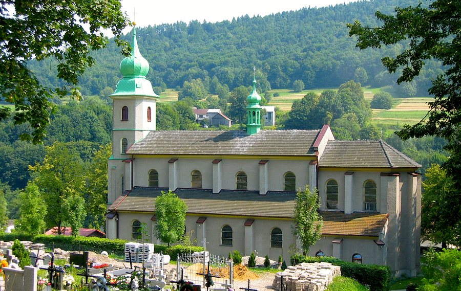
Tarnawa Dolna at a glance
- Location: on the Kalniczka and along the route toward Komańcza.
- Local history: The shared settlement was divided in the 17th century; its later names, Tarnawa Dolna and Tarnawa Górna, remain in use today.
- Cycling route: “Wzgórze Gruszka” runs from Lesko toward Zagórz and passes Tarnawa Dolna.
How did Tarnawa become Tarnawa Dolna?
The local history begins with a settlement that was not yet divided into Tarnawa Dolna and Tarnawa Górna. This historic settlement was first mentioned in a document in 1402; Mikołaj z Tarnawy was its owner. In the 17th century, the originally shared settlement was divided into Tarnawa Niżna and Tarnawa Wyżna. The names later changed to Tarnawa Górna and Tarnawa Dolna; this division remains in place today.
The shared settlement’s location on the historic road over the Łupkowski Pass to Hungary is also part of this earlier history. Two aspects of its development can therefore be distinguished: the later place names make the division visible, while the pass road describes the historic connection toward Hungary.
What are the key stages in Tarnawa’s history?
The shared settlement of Tarnawa had religious and economic milestones spanning several centuries. A Greek Catholic church stood there from 1537. In the 18th century, there was a saltworks, which closed in the early 19th century. A Roman Catholic parish was established in the historic settlement in 1908; a parish church was built there between 1924 and 1933.
This timeline links different chapters in the settlement’s shared history: the early church was followed by salt production, the establishment of a parish, and the construction of a parish church. The dates place these milestones in context without combining them into a single period.
What is the route of the “Wzgórze Gruszka” cycling trail?
The cycling trail runs from Lesko toward Zagórz via Postołów. Along a forest track, it passes Łysa Góra (420 m), goes through Tarnawa Dolna, and runs along the hills of Makówka (497 m) and Gruszka (583 m). The elevations listed rise from 420 m to 497 m and then 583 m, helping distinguish the three terrain features.
Next, a forest track leads to Łukowe. The route continues through the Tarnawka (Kalniczka) valley to Średnie Wielkie and, via Choceń, a village that no longer exists, to Cisowiec. Tarnawa Dolna is therefore one point on a longer route, not its endpoint. If you are planning a cycling trip along the route, check the current condition of the trails before setting off.
Discover more destinations: Zagórz, Mrzygłód, Siemuszowa, Sanok, Tyrawa Solna, Mokre, Dębna, Nowy Łupków.
FAQ
Which body of water is Tarnawa Dolna on?
Tarnawa Dolna is on the Kalniczka.
How did the shared settlement come to be divided?
In the 17th century, the originally shared settlement was divided into Tarnawa Niżna and Tarnawa Wyżna. The names later changed to Tarnawa Górna and Tarnawa Dolna.
When did the saltworks operate in Tarnawa?
The saltworks operated in the 18th century and closed in the early 19th century.
For the main travel overview: Sanok.

