
Bitarová: History, Landscape and the “Za krásami Súľova” Route
Accommodation in Bitarová
Landscape and Location
Bitarová lies in the western part of the Žilina Basin, in the valley of the Bitarovský potok. The municipality’s territory features an almost forest-free, hilly landscape with marshy depressions and flat ridges; small woodland areas lie in the southwest and northeast of the municipality. In spring and autumn, a bird migration route passes through Bitarová. The geographical setting, landforms and seasonal connection with nature each place different emphasis on the area, and can be considered separately when planning a trip. Those who do not want to combine nature observation, local history and physical activity into a single theme can read the information as separate areas of focus.
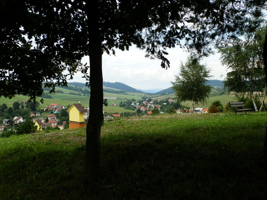 File:Bitarová z vrcholu kalvárie - panoramio.jpg
Photo: Michal Jakubský via Wikimedia Commons, CC BY 3.0
File:Bitarová z vrcholu kalvárie - panoramio.jpg
Photo: Michal Jakubský via Wikimedia Commons, CC BY 3.0
More local pages: Rajecke Teplice, Višňové, Dlhé Pole, Terchová, Jasenové, Stráža, Lietavská Svinná-Babkov, Čičmany
History and Rural Tradition
Bitarová was first mentioned as a municipality in 1393. Historically, Bitarová was part of the Lietava estate. A settlement of the Lusatian and Púchov cultures existed in the municipality’s territory during the Late Bronze Age.
In the 17th century, Bitarová had carp ponds that were also used for fishing. Traditional rural activities in Bitarová included beekeeping and sheep farming. In addition, the municipality of Bitarová decided to revive the old custom of burning the Jánska vatra bonfire. For choosing individual areas of focus, the archaeological, economic and community aspects can be read separately.
When comparing hotels in Bitarová, you can compare travel dates, room categories and cancellation conditions on the respective offer pages. This places booking details alongside the town’s main points of interest for personal planning.
Cultural Sites and Religious Connections
The Church of Saint Augustine in Bitarová dates from 1992. The municipality’s territory contains a Slovak burial ground with burial mounds dating from the period of the Great Moravian Empire. The Bitarová Calvary consists of small Stations of the Cross chapels arranged in two rows and connected by a Way of the Cross.
A path at the Bitarová Calvary leads to a cross, a double cross and a memorial stone for the local believers buried there; the site is located on the grounds of an old cemetery. The layout, path and memorials each serve as separate points of reference when orienting yourself at this cultural site. During the patronal celebrations for the Feast of Saint Augustine, a Mass is celebrated at the Calvary every year.
Cycling Route
For a day’s itinerary, the tour and the cultural sites can be treated as separate activities. The 27-kilometre moderate-difficulty “Za krásami Súľova” tour runs from Žilina via Bitarová, Peklina, Rôsoviny pod Roháčom, Hričovské Podhradie, Ovčiarsko and Hradisko, returning to Žilina.
At the beginning of Bitarová, the route turns off the main road behind the town sign. At the junction by the municipal office, shortly before the chapel, the route turns left again.
For the higher-level travel overview: Žilina District.

