
Imeľ between the Nitra floodplain and dune sands
Accommodation in Imeľ
Imeľ features two distinct landscapes: the western part lies on the wet floodplain of the Nitra, while the eastern part lies on a low elevation with extensive windblown sand deposits. In places, the dunes reach heights of up to 10 metres.
Nature
The Veľké lúky area extends across the cadastral territories of Imeľ and Nesvady. Remnants of the Veľké lúky wet meadows have been preserved on the right bank of the Nitra; in places, there are wet areas with reed growth. The European roller (Coracias garrulus) breeds in this area.
The Dolné Považie Special Protection Area includes the cadastral territory of Imeľ. The Dolné Považie area falls under the jurisdiction of the Dunajské luhy Protected Landscape Area. The flat and wet habitats of Dolné Považie provide a good food source for the Western marsh harrier (Circus aeruginosus). Woody vegetation, scattered trees and shrub stands create suitable breeding conditions for the tawny pipit (Anthus campestris), the lesser grey shrike (Lanius minor), the Syrian woodpecker (Dendrocopos syriacus) and the European roller (Coracias garrulus).
The dune-sand area in the east of Imeľ consists of sand and woodland, which are predominantly covered by stands of acacia. The summit area of the hill in Imeľ’s dune-sand area is covered with well-preserved psammophilous vegetation. The dune-sand area is valuable because of the secondary diversity of its flora, vegetation cover and psammophytic plant communities. The differences between the floodplain, wet meadows, dunes and woodland help you compare the natural features by landscape type. The bird species and plant communities mentioned add animal and vegetation-related aspects to this classification.
For interpreting the natural features, the landscape types provide a useful basis for comparison: wet meadows, reed areas and flat habitats contrast with the sandy dunes and woodland. Bird species, woody vegetation and psammophilous vegetation represent different specialist aspects within this presentation. This keeps habitats, plant cover and wildlife distinct rather than combining them into a general description of nature.
Townscape
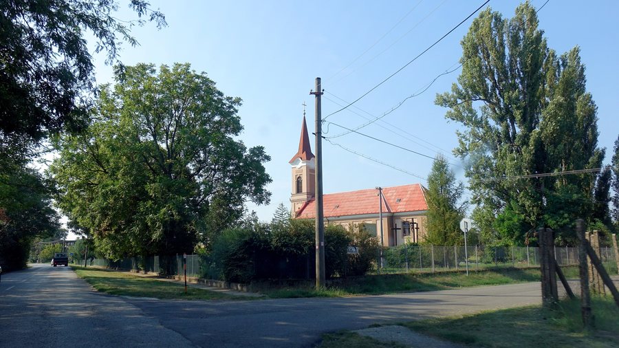
The Roman Catholic Church of Saint John the Baptist in Imeľ dates from 1800. The Reformed Church in Imeľ dates from 1888. The Božie muky wayside monument in Imeľ dates from 1831.
Weaving, basketry, the processing of corn straw and embroidery were widespread in Imeľ. The memorial plaque dedicated to József Blaskovics in Imeľ commemorates the linguist, Turkologist and translator József Blaskovics. There is a municipal library at Školská 91/4, 946 52 Imeľ.
Other places: Vrbová Nad Váhom, Čalovec, Holiare, Kameničná, Okoličná Na Ostrove, Nesvady, Hurbanovo, Lipové
When comparing hotels in Imeľ, you can view the travel dates, room category and cancellation conditions side by side. Offers can be arranged based on specific details; the focus is on the information relevant to your travel plans. In Imeľ, these accommodation details can be considered separately from the descriptions of nature, the townscape and bodies of water.
Bodies of water
The 1-hectare water surface of a gravel pit near the municipality of Imeľ is designated as a carp fishing water.
For the broader travel overview: Komárno District.

