
Podhradní Lhota: Castle Ruins, Mountain Views and Cycling Tour
Accommodation in Podhradní Lhota
Podhradní Lhota lies at the foot of Kelčský Javorník, the highest peak of the Hostýnské vrchy. Geographically, the village is situated between a named peak and the historical sites around Šaumburk and Nový Šaumburk. For planning purposes, the landscape, culture, rail connection and cycling route can be considered as different approaches.
Landscape and Panoramic Views
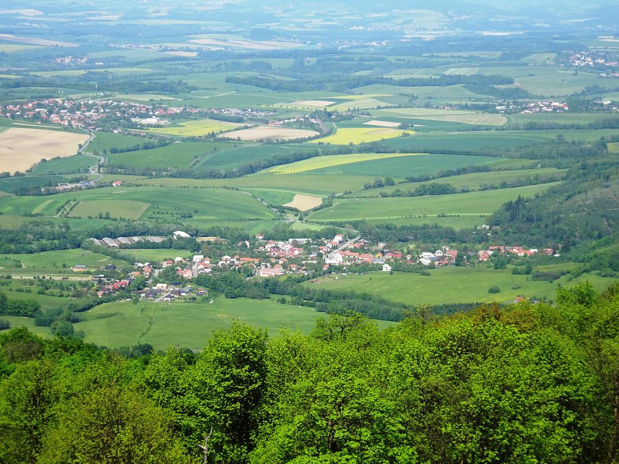
From Šaumburk, there are views of the ridges of the Hostýnské vrchy and the surrounding landscape. The location at the foot of Kelčský Javorník and the viewpoint near Šaumburk represent two different spatial perspectives. You can read this information separately and give it different weight depending on your preferred daily rhythm.
Culture and History
Šaumburk is a castle ruin located southwest above Podhradní Lhota. It was built in the years after 1272 by the Olomouc bishop Bruno von Schauenburg. The chronology and location provide the historical site with two clearly distinguishable reference points.
The Nový Šaumburk castle ruin, mistakenly known as Zubříč, is located in the Bašta area at an elevation of 530 m above sea level, southeast of Podhradní Lhota. On the oval central area of Nový Šaumburk, the remains of the outer wall and a moat, as well as sections of masonry, are clearly visible in places. At Šaumburk, relief-like remains of buildings, ramparts and moats have also been preserved.
The restored Chapel of the Seven Sorrows of the Virgin Mary is also part of the historical context. It dates from the 19th century and stands near the bus stops. Those examining the cultural reference points can thus distinguish between a castle ruin with a dated origin, preserved terrain structures and a later sacred building.
For classification purposes, the cultural sites mentioned differ in their dating, location and the structural or relief-like features preserved in each case.
Rail and Cycling Route
Podhradní Lhota railway station is located on line 303 between Kojetín and Valašské Meziříčí. All platforms at Podhradní Lhota railway station are accessible without barriers. For personal travel planning, a clearly identified rail connection is available alongside the routes arising from the cultural and cycling routes.
The 32 km Tesák cycling tour via Troják passes through Podhradní Lhota. From Podhradní Lhota, the cycling tour continues to Rajnochovice and then connects to route 5120 and the Hostýnské vrchy nature trail. You can consider the specific tour distance and the named connections separately when planning, for example as an individual cycling tour or in connection with longer routes.
A hotel in Podhradní Lhota can be assessed during travel planning using travel dates, room category and cancellation conditions. This information forms a separate level of comparison alongside the landscape, cultural, rail and cycling information described above. This allows you to consider accommodation details and information about the area separately, without mixing up the historical and geographical details.
Other Places
Other places in this selection: Honětice, Kremsier, Slavkov Pod Hostýnem, Zlobice, Hulín, Rymice, Rajnochovice, Rusava
For the overview of the wider travel area: Kroměříž District.

