
Câlnic: Fortress, Church and Hilly Landscape
Accommodation in Câlnic
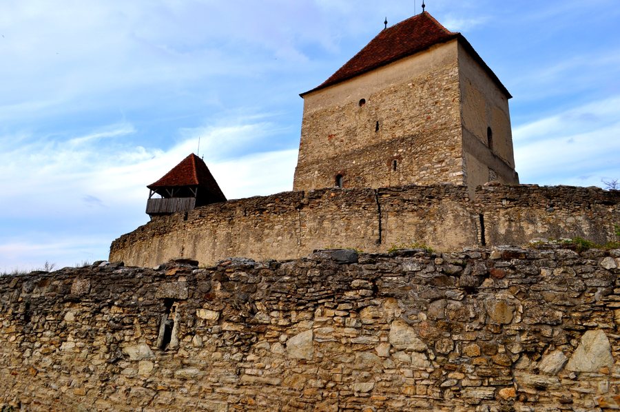
Câlnic and its fortress are part of the UNESCO World Heritage. The rural fortress is considered the best-preserved example of a fortification that developed from fortified noble residences and was taken over by Saxon communities. It also preserves one of the last Greve residences in Transylvania.
Culture and History
The fortress of Câlnic was built around 1270. Its original complex included a donjon, a defensive wall, and a water-filled moat; access was possible only via a drawbridge. The present-day fortress consists of two concentrically arranged oval curtain walls, reinforced by two towers and a bastion.
The fortress chapel has a Gothic western portal and a wooden gallery dated 1733, with panels painted with floral motifs. Inside, it also preserves fragments of a fresco from the early 16th century. One of the fortress towers is also known as “Turnul slăninii” or “Butchers’ Tower.” Another fortress tower is called “Turnul clopotelor,” meaning bell tower, because of its four bells.
The present-day structure of Câlnic’s Evangelical Church dates from the 15th century and was extensively altered in the 19th century, giving it its current Neo-Gothic appearance. Its western gallery houses an organ from 1867, built by Carl Hesse of Vienna. Archaeological investigations in the present-day Evangelical Church revealed a small older hall church, whose construction presumably began around 1100.
The medieval church of Câlnic preserves a Gothic choir and a western façade with two western towers. An around-1300 tombstone of Nicolaus was found in the Evangelical Church, which the archaeologist described as a unique epigraphic piece in Romania. The listed church includes painted choir stalls made in Sighișoara around 1780. A virtual tour of the Evangelical Church is also available online.
Landscape and Routes
Câlnic lies in the western part of the Apold Depression, in a hilly landscape crossed by the Câlnic Stream, a tributary of the Secaș. At the same time, the village is located in the Sebeș–Apold depression corridor, a hilly landscape with elevations between 300 and 600 metres. Road access includes the DJ 106F towards Gârbova and the DC 49 towards Deal.
On a cultural cycling tour through historic towns and Saxon villages, the Evangelical Church of Câlnic is designated as a destination. The 129-kilometre Route III runs from Câlnic via Gârbova, Miercurea Sibiului, Săliște, Cristian, Sibiu, Cisnădie, and Cisnădioara, returning to Câlnic. In Câlnic, the traditional event “Datina străbună pe Secașe” was presented on 1 February in its 32nd edition.
For Câlnic, hotels can be compared based on travel dates, room category, and cancellation conditions. The selection remains focused on your own plans; the fortress, church, and hilly landscape represent different thematic focuses that can be taken into account when planning a stay.
More places: Pianu De Jos, Rimetea, Sohodol, Pianu De Sus, Laz, Blaj, Pleși, Albac
For the higher-level travel overview: Alba.

