
Mihai Viteazu: Cultural History, Valley and Mountains
Accommodation in Mihai Viteazu
If you would like to consider history and landscape together when choosing a destination, the themes of Mihai Viteazu can be clearly distinguished from one another. This structure combines historical context, geographical location and nature activities without conflating the individual connections.
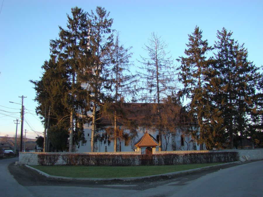 File:Biserica reformata din Mihai Viteazu (3).JPG
Photo: Țetcu Mircea Rareș via Wikimedia Commons, CC BY-SA 3.0 ro
File:Biserica reformata din Mihai Viteazu (3).JPG
Photo: Țetcu Mircea Rareș via Wikimedia Commons, CC BY-SA 3.0 ro
For further comparison, you can also consider Floreşti, Beliş, Gilău, Someșu Cald, Margau, Săvădisla, Negreni and Sic.
In Mihai Viteazu, historical evidence and landscapes come together: archaeological areas, religious buildings, the Arieș Valley and the mountain ranges offer different ways of approaching the area.
Culture
The “Drumul văii” archaeological area includes a settlement from the transition period to the Bronze Age, associated with the Coțofeni culture. When making a historical comparison, you can consider the period and cultural classification separately.
The Biserica unitariană de la Mihai Viteazu is a religious building in Mihai Viteazu dating from the 18th century. Moving between the archaeological area and the religious building opens up two different types of place for chronological classification. The type of place and the period can be considered separately.
The Roman settlement of Mihai Viteazu – Fântâna Şai is an archaeological settlement near the “Şai” fountain and dates from the Roman period. The fountain provides the spatial reference, while the Roman period provides the chronological classification.
Another archaeological reference point is the Valea Pordei area. It is located in the northwestern part of the municipality of Mihai Viteazu, on the left-hand side of county road DJ103G. Specifying the part of the municipality, compass direction and side of the road makes the spatial classification precise.
Landscape and Location
The municipality of Mihai Viteazu lies at the foot of the Apuseni Mountains along the Arieș Valley. It is also located in the contact zone between the Trascău Mountains and the Transylvanian Plateau. For geographical classification, you can consider the valley, mountain foothills and contact zone as different references alongside one another.
The municipality of Mihai Viteazu lies on DN 75, an important transport route connecting it with the settlements in the Apuseni Mountains. When planning, the transport relevance of DN 75 can be considered separately from the landscape designations.
Nature and Activities
In the surrounding area, Cheile Turzii is considered a natural monument with plant species unique in Europe, a diverse animal life, rocky walls and caves. In the surrounding area, Cheile Turzii is considered an area for mountain sports, orienteering and leisure activities. Cheile Turzii has approximately 140 climbing routes. Mountain sports, orienteering, leisure activities and climbing represent different types of activity; the approximately 140 routes identify the explicitly mentioned connection with climbing within this spectrum.
For your travel planning in Mihai Viteazu, the archaeological sites and Cheile Turzii can provide different thematic points of reference. When choosing a hotel, travel dates, room category and cancellation conditions can be considered as separate criteria. Accommodation details stand alongside the area's cultural and nature-related themes; the appropriate weighting depends on your travel plans and personal budget.
For the broader travel overview: Cluj-Napoca.

.JPG)