
Jestice: Hotels amid Nature and History
Accommodation in Jestice
Jestice lies in the eastern part of Cerová vrchovina, in the valley of the upper reaches of the Mačací potok stream. The village combines a distinctive landscape with small, tangible reminders of the region’s architectural, musical and settlement history.
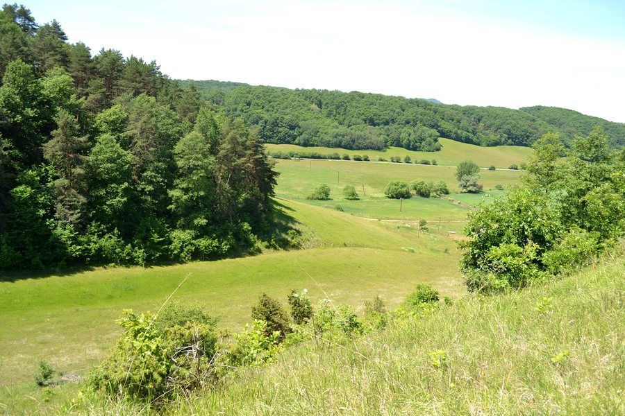 File:Jestice - Hradný vrch Jestice -1a.jpg
Photo: Ladislav Luppa via Wikimedia Commons, CC BY-SA 4.0
File:Jestice - Hradný vrch Jestice -1a.jpg
Photo: Ladislav Luppa via Wikimedia Commons, CC BY-SA 4.0
Nature
Part of the Cerová vrchovina Protected Landscape Area lies within the cadastral territory of Jestice. Jestice is also one of the cadastral territories included in the Cerová vrchovina a Rimavská kotlina Natura 2000 protected area. The Cerová vrchovina Protected Landscape Area was first designated by Decree No. 113/1989 Coll. of the Ministry of Culture of the Slovak Socialist Republic, dated 10 October 1989, with an area of 16,280 ha.
Cerová vrchovina has a distinctive volcanic relief, although volcanic rocks cover less than 10 % of its area; most of the mountain range consists of sandstone. The Cerová vrchovina a Rimavská kotlina Natura 2000 protected area, which includes Jestice among its cadastral territories, has warm and dry conditions suitable for the breeding and survival of the woodlark (Lulula arborea), scops owl (Otus scops) and European bee-eater (Merops apiaster).
Cerová vrchovina–Porimavie is one of the three most important areas in Slovakia for the breeding of the woodlark (Lulula arborea) and one of the five most important areas for the breeding of the scops owl (Otus scops) and European bee-eater (Merops apiaster). In the Cerová vrchovina–Porimavie Special Protection Area, important bird habitats include forests, poplar avenues and other avenues, riparian stands of willows and alders, orchards, vineyards, rocky scree and other rocky habitats.
Culture
The central structure in Jestice is a bell tower. The village also has characteristic vernacular houses. The Jestice municipal office building contains a permanent local exhibition dedicated to folk art and the preservation of traditions, which visitors can view at any time. The local sacred architecture includes a chapel dedicated to Saint Andrew, dating from 1996.
Musical traditions are also connected with Jestice. Three folk music recordings from 1974 and 1985 originate from Jestice. The dances “Karéj”, “Csárdás” and “Csárdás, ugrató” are associated with Jestice. The exhibition “Hrady v Gemeri-Malohonte” at the Gemersko-malohontské Museum in 2015 presented archaeological finds from Jestice–Várhegy.
History
Hrádok Jestice was probably a small medieval fortress whose southern approach was protected by raised earth ramparts. The fortification can be dated to the Árpád period. Its existence is also associated with a written reference from 1333/1334, in which the castle hill is called “mons Waarheg”. Finds such as a key, a knife and horseshoes provide evidence of settlement from the 11th to the 13th century.
Today, only modest earth ramparts approximately three metres high remain of Hrádok Jestice, overgrown with dense woodland. Thus, the site is not centred on a fully preserved structure, but on a historical fortification that is only subtly visible.
Hiking and Trails
The best route to Hradný vrch begins in Jestice at the municipal office, follows a road towards the cultural centre and then continues along a field path. The route is not officially marked with hiking signs, takes approximately 30 to 40 minutes on foot and should be followed with a map or GPS.
For further exploration, you can also visit Kráľ, Klenovec, Kraskovo, Štrkovec, Martinová, Gemerček, Dubovec and Hnúšťa.
For the higher-level travel overview: Rimavská Sobota District.

