
Babiná – History, Cycling Routes and Landscape
Accommodation in Babiná
The Babiná Heritage Conservation Zone was designated on 25 September 2000. Its protected historic zone features an organic, clustered street-settlement structure with an irregular layout. The panoramic views from this zone are complemented by the surrounding landscape of the Štiavnické vrchy.
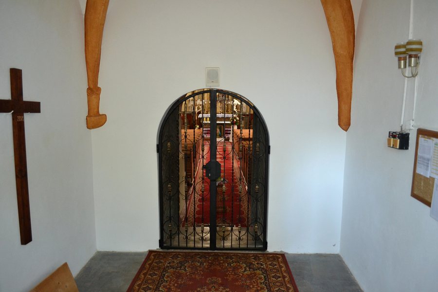 File:Babiná - Kostol sv. Matúša - interiér -d.jpg
Photo: Ladislav Luppa via Wikimedia Commons, CC BY-SA 4.0
File:Babiná - Kostol sv. Matúša - interiér -d.jpg
Photo: Ladislav Luppa via Wikimedia Commons, CC BY-SA 4.0
Culture and History
The traditional farmhouse in Babiná was built in 1820 and has a U-shaped layout with subsequently constructed farm buildings, including a granary, stables and a barn. The Romanesque Roman Catholic Church of St. Matthew in Babiná was built between 1242 and 1254. It contains a Romanesque stone baptismal font from the 13th century. It also has a Gothic bell dating from 1358 with a Gothic inscription. The archaeological site of Pod múrom in Babiná is part of the area’s earlier settlement history. It contains pottery fragments and bronze objects from the later prehistoric period.
For context, you can consider several scales side by side. A townscape can be read differently from a single building, and a church interior differently from an archaeological site. The dates also establish a chronological framework, while the different types of objects indicate different approaches to history. These perspectives do not have to be combined into a single narrative; they can be considered separately and compared with one another. The terms remain clearly distinguishable from each other.
Hiking and Cycling
The centre of Babiná is a hub for hiking trails, particularly the Rudná magistrála. The traditional “Chotárom obce” hiking march takes place every year and leads along forest paths and meadows to remote parts of the Babiná municipal area. Beside the central children’s playground in Babiná, a wooden information board displays the entire cycling network of the PK microregion. The cycling network of the PK microregion comprises three routes in green, blue and yellow, connecting the municipalities of the microregion. The three cycling routes of the PK microregion are 36.30 kilometres long in total.
For the routes, you can consider the features separately. Hiking trails, cycling routes and a traditional hiking march can be compared as different types of activity. The cycling routes can be distinguished by their total length and colour coding; for the hiking event, its annual recurrence provides a different temporal reference. The connections between the municipalities and the routes through forests, meadows and remote parts of the municipal area also provide factual points of reference for personal planning. Depending on the desired basis of comparison, you can give greater weight to individual features.
Accommodation
When comparing hotels in Babiná, you can first place travel dates, room category and cancellation conditions side by side on the offer pages. These fields provide an objective framework for personal planning and can be checked against the same criteria for several offers.
Other Places
Zvolenská Slatina, Kováčová, Ostrá Lúka, Zvolen, Očová, Hronská Breznica, Breziny, Sliač
To the higher-level travel overview: Zvolen.

