
Ižipovce – Cave, Gorges and Hiking Trails
Accommodation in Ižipovce
Ižipovce lies in the central part of the Liptov Basin below the Choč Mountains at an elevation of 598 m. Directly above Ižipovce is Jaskyňa nad Ižipovcami, a 20 m long limestone cave.
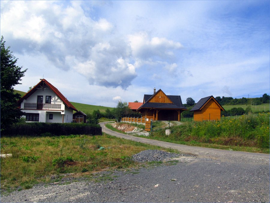 File:Ižipovce - cesta do Liptovskej Anny - panoramio.jpg
Photo: Jan Starec via Wikimedia Commons, CC BY-SA 3.0
File:Ižipovce - cesta do Liptovskej Anny - panoramio.jpg
Photo: Jan Starec via Wikimedia Commons, CC BY-SA 3.0
Landscape
The Prosečné Site of European Importance includes the cadastral area of Ižipovce. The Prosečné protected area has a limestone and dolomite substrate as well as a typical cliff relief. The characteristic natural features include the deep gorges of the Prosiecka and Kvačianska valleys. The Prosiecka Valley lies near Ižipovce and can also be reached on foot from Ižipovce.
In the landscape of Prosečné, geological formations meet deeply incised valleys. The limestone and dolomite substrate forms the setting described for the cliff relief, while the gorges of the Prosiecka and Kvačianska valleys constitute a distinct part of the landscape. Thus, open rock formations, deeply incised valleys and access to the cave above the village stand side by side in the area.
Cave
Jaskyňa nad Ižipovcami lies in the cadastral area of Ižipovce and is a fluviokarst cave with archaeological finds. The low entrance measures 40 × 60 cm; after approximately 2 m of crawling, it leads into an oval-shaped chamber. The location and form of the entrance therefore differ significantly from the open paths through the protected area and the valleys.
Nature and Trails
The 4,294 m long Janošíkov stôl hiking route passes through Ižipovce. The ascent to Jánošíkov stôl is considered relatively steep; occasional views of Liptovská Mara can be seen through the trees. A circular hike to Jánošíkov stôl (Čerenová skala) from Liptovská Anna is an easy alpine hike covering 8 km, with 459 m of ascent and 459 m of descent, and lasting 3 hours.
The hiking options differ in length, elevation gain, duration and trail character. The Janošíkov stôl route passes through Ižipovce; the circular hike from Liptovská Anna leads to Jánošíkov stôl (Čerenová skala), while the valley route connects Prosiek with Kvačany. This provides different distance, time and terrain details for planning a day trip.
The route through the Prosiecka and Kvačianska valleys leads from Prosiek to Kvačany and takes six hours. The more difficult sections in the lower and upper parts of the Prosiecka Valley are completed with the aid of technical equipment. Route length, elevation profile, duration and the technical trail sections are therefore separate characteristics of the hikes described.
The Liptovská Mara reservoir lies near Ižipovce. In the vicinity of Ižipovce, Liptovská Mara offers opportunities for swimming, paddleboarding and boat trips.
Culture
Historical livelihoods and crafts in Ižipovce included agriculture, cloth weaving, blacksmithing, carpentry and the production of handričkové korovce.
The activities mentioned range from agriculture as a livelihood to several craft fields. Cloth weaving, blacksmithing and carpentry stood alongside the production of handričkové korovce. The history of the village was thus shaped both by agricultural work and by various forms of craft production.
Other Places
Other locality pages include Vazec, Huty, Maluzina, Jakubovany, Liptovska Anna, Vlachy, Svätý Kríž and Liptovské Matiašovce.
For the broader travel overview: Liptovský Mikuláš District.

