
Nitrianske Pravno: Calvary, Culture and Trails
Accommodation in Nitrianske Pravno
Nitrianske Pravno features a distinctive townscape with sacred architecture, historical landmarks and trails through the surrounding landscape. On the main square, the old town hall is the characteristic building and dominant structure of Nitrianske Pravno. This central landmark is complemented by a parish church dedicated to Saint John the Baptist, the Calvary on Galgensberg, museums and traces of earlier settlement.
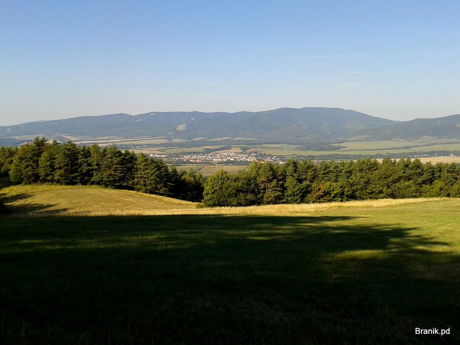 File:972 13 Nitrianske Pravno, Slovakia - panoramio (2).jpg
Photo: Branik P via Wikimedia Commons, CC BY-SA 3.0
File:972 13 Nitrianske Pravno, Slovakia - panoramio (2).jpg
Photo: Branik P via Wikimedia Commons, CC BY-SA 3.0
Culture
The Roman Catholic parish church was originally a stone Gothic church built in the first decades after the town was founded. On Galgensberg hill stands the Calvary, a unique complex of 27 sacred buildings in the Neo-Gothic style. Fourteen chapels depicting the Stations of the Cross are connected by a winding path. The upper part of the Calvary offers views of the upper Nitra Basin.
Among the notable historical buildings is the wooden bell tower in Vyšehradné. It was built in 1802, designated a national cultural monument in 1996 and is one of the oldest bell towers of its kind in Slovakia. The Haronika House collection includes ceramic vessels, folk-art objects made of metal, wood, leather and textiles, as well as traditional clothing. Haronika House in Vyšehradné also features a small museum dedicated to living and traditional clothing, along with the “Keramika Haronika” ceramics workshop.
Another cultural attraction is the Museum of the Carpathian Germans from Bratislava. It houses a permanent exhibition entitled “History and Culture of the Carpathian Germans in Hauerland”. Museum visits are available by prior telephone appointment. Vyšehrad also contains evidence of the earliest settlement from the Late Stone Age and Late Bronze Age, as well as traces of Slavic settlement.
Nature
The Solka–Vyšehrad educational trail is an approximately 8 km circular route of moderate difficulty. It has an elevation gain of 495 metres and takes about 3 to 4 hours at a hiking pace. The trail provides information about the history of the area as well as the local fauna and flora. Its route length, elevation profile and estimated hiking time can help you plan your day.
Activities
Nitrianske Pravno can also be included in a longer cycling route. One cycling route begins in Nitrianske Pravno, leads via Tužina towards Temeš and returns to Nitrianske Pravno via Handlová, Remata and Ráztočno. It is intended for more experienced cyclists and includes climbs to mountain passes as well as rides on paved and unpaved forest roads. In addition to the moderate educational trail, the town therefore offers considerably more demanding cycling kilometres with changing surfaces and elevation differences.
Those choosing Nitrianske Pravno as a travel destination can view or compare hotel offers in the town. When planning, you can take your personal priorities and intended scope of travel into account. This keeps the choice of accommodation focused on individual preferences without presupposing a particular option.
The following town pages are also available for your further selection: Dolné Vestenice, Prievidza, Liešťany, Nitrica, Lehota Pod Vtáčnikom, Šútovce, Opatovce Nad Nitrou and Kamenec Pod Vtáčnikom.
To the higher-level travel overview: Prievidza.

.jpg)