
Kaloša – History at the Slovak Ore Mountains
Accommodation in Kaloša
Kaloša can be explored through its multilayered local history and a clearly described landscape. Historical forms of the name, changing ownership and specific population figures make the development of Vyšná Kaloša particularly comprehensible. At the same time, the church, manor house, valley area and approach to the village provide the municipality with different spatial and temporal points of reference.
History
Vyšná Kaloša was established at the end of the 14th century through its separation from Nižná Kaloša. In 1427, Vyšná Kaloša is documented under the historical name Kalosa, while the form Felsew Kalosa is recorded for 1458. Vyšná Kaloša was first mentioned in 1477 as the property of the Nádaždy family. At the beginning of the 16th century, part of the municipality of Kaloša came into the possession of the Lórantfy family. During Ottoman rule, the municipality of Kaloša was looted.
The municipality of Kaloša's historical heritage includes a late Neoclassical Reformed church dating from 1889. Nižná Kaloša is also home to a Neoclassical manor house built in the first half of the 19th century. Both buildings stand within a historical context complemented by the recorded place names and the ownership history of various families.
The social conditions are also documented for several points in time. In 1773, twelve serf families lived in the municipality of Kaloša. In 1828, 140 inhabitants in 17 houses are recorded. The municipality of Kaloša retained its agricultural character during the First Czechoslovak Republic. The documented development therefore extends from medieval forms of the name and ownership history to the economically shaped structures of more recent times.
Landscape
The municipality of Kaloša lies in the northern part of the Rimavská Basin, at the southern foot of the Slovak Ore Mountains and in the valley of the middle course of the Kaloša stream. These three geographical references describe the landscape from different perspectives: the basin places Kaloša in its regional context, the mountain foothills mark the northern edge of the landscape, and the stream identifies the municipality's valley area.
Vyšná Kaloša belongs to the Vály Valley. Traditional dances and a traditional dancing culture have been preserved in this valley. This cultural heritage thus stands alongside the historic buildings and place names as a separate element of the region's character.
Village Structure and Access
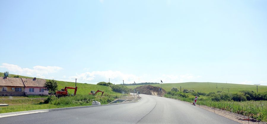
Vyšná Kaloša is a cul-de-sac village and can be reached via a one-kilometre road that branches off the Gömörfüge–Felsővály secondary road. The bus stop “Kaloša, Vyšná Kaloša, rázc.” is also relevant for public orientation; it is included in the official list of stops. The village structure and the name of the bus stop distinguish the actual destination from the higher-level road connection.
On the respective offer page for Kaloša or Vyšná Kaloša, visitors can first check the exact location and type of accommodation. They can also review occupancy, included services and the individual price components. Before booking, the conditions stated there for changes or cancellation are also important.
Other Places
Other destinations for exploring the same area: Chrámec, Rimavská Baňa, Ivanice, Budikovany, Dubovec, Teplý Vrch, Rimavská Seč, Drňa.
For the higher-level travel overview: Okres Rimavská Sobota.

