
Kremnické Bane: Hotels and Mining History in the Kremnica Mountains
Accommodation in Kremnické Bane
Kremnické Bane lies in the Kremnica Mountains in a valley at an altitude of 700 to 800 metres above sea level. The originally German mining settlement was first mentioned in 1361. Part of the village was designated a rural heritage conservation zone by Decree No. 1/1994 of the District Office of Žiar nad Hronom in order to preserve the cultural values of Kremnické Bane permanently. In this way, the landscape, settlement history and preserved buildings form a clear historical context.
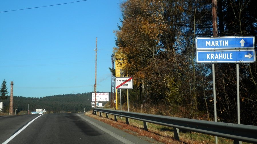 File:Kremnické Bane 21 Slovakia 1.jpg
Photo: Ing.Mgr.Jozef Kotulič via Wikimedia Commons, CC BY-SA 4.0
File:Kremnické Bane 21 Slovakia 1.jpg
Photo: Ing.Mgr.Jozef Kotulič via Wikimedia Commons, CC BY-SA 4.0
Culture
One of the notable buildings is the Church of St. John the Baptist, “Kostol sv. Jána Krstiteľa”, a three-nave Gothic structure dating from the second half of the 13th century. It was originally built as a Romanesque rotunda. The star-ribbed vault of the rotunda, dating from the 15th century, has survived largely intact to this day. Above the village, next to this Gothic church, there is a symbolic centre of Europe.
Another historic site is the Chapel of the Nativity of the Virgin Mary, “Kaplnka Narodenia Panny Márie”. It was originally a Baroque chapel from 1726 and was remodelled in the Neo-Gothic style in 1910. Inside, there is a folk woodcarving of Saint John of Nepomuk from the 18th century. The village landscape also includes an ensemble of one- and two-storey miners’ houses with hipped roofs and shingle roofing dating from the 18th and 19th centuries.
The textile history of Kremnické Bane has also been preserved. In the 1890s, an institutionally organised bobbin-lace school operated here. During the Austro-Hungarian period, the village became a centre of lace production. The events calendar also features recurring customs: every year during the carnival season, a masked procession takes place, and traditional goulash is served, among other things, at the annual Jánska vatra bonfire celebration.
Mining is linked to a 20-kilometre-long miners’ water conduit from the 15th century. It carries water to the reservoirs of Kremnické Bane. The history of the village therefore extends beyond individual buildings and also encompasses technical installations from its mining era.
Landscape
Near the church lies the rock of Trnovník, also called Dornstein or Dorn Stein. At 990 metres, it is the highest point in the local cadastral area. From Trnovník, views extend south as far as Banská Štiavnica and north towards the ridge of the Little Fatra. The rock thus combines a named landscape feature with a broad view over the surrounding areas.
Things to Do
The “Cesta hrdinov SNP” hiking trail passes through Kremnické Bane. In the village, it branches off towards the Church of St. John the Baptist, “Kostol sv. Jána Krstiteľa”. In addition, the “Po stopách baníckej činnosti Kremnica–Kremnické Bane” educational trail system consists of three main trails and three side trails. It presents the mining history of the region. Along this educational trail, only the ruins of the original miners’ houses remain today.
More pages about nearby places: Bartošova Lehôtka, Kunešov, Jastrabá, Slaská, Dolná Ves, Nevoľné, Sklené Teplice, Stará Kremnička.
For the overarching travel overview: Žiar Nad Hronom.

