
Klacno (Kľačno): Hotels, Hiking Routes and Local History
Accommodation in Klacno
Kľačno lies in the northern part of the Upper Nitra Basin on both sides of the Nitra River at an altitude of 360 to 460 m above sea level. The Nitra River rises below Reváň. At the source, there is a footbridge and a covered seating area with benches.
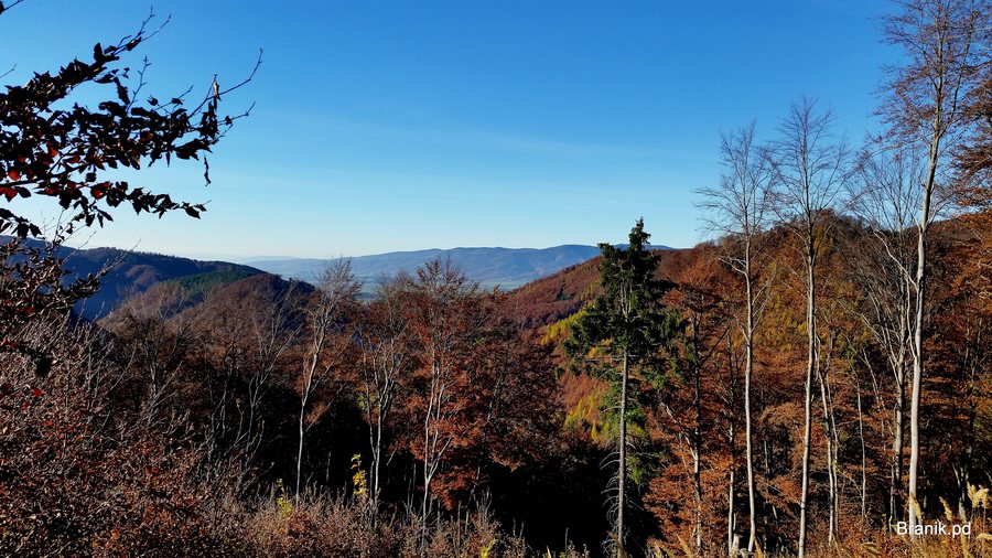 File:972 15 Kľačno, Slovakia - panoramio (35).jpg
Photo: Branik P via Wikimedia Commons, CC BY-SA 3.0
File:972 15 Kľačno, Slovakia - panoramio (35).jpg
Photo: Branik P via Wikimedia Commons, CC BY-SA 3.0
Nature
Kľak is a 1,352 m high peak. The Kľak State Nature Reserve was established in 1966 over an area of 86 ha. Protected plant species grow on the dolomite rock of Kľak, including škarda sibírska, timotejka sibírska, soldanelka karpatská, žltohlav európsky, prilbica pestrá and zvonček karpatský. The Kľacký Waterfall is located below Kľak.
History and Local History
The church was first mentioned in writing in 1464. It has an Early Gothic origin; a parish already existed at this site in the 13th century. The Marian column in front of the church was erected in 1749 and declared a cultural monument in 1966. A chapel was built in 1824, and the Lourdes Chapel in 1931.
The municipality was called Gajdel until 1948 and was then renamed Kľačno. Historically, Gajdel was known for dried plums, which were also sold in Vienna. Thus, in addition to the older religious buildings, a traditional local connection is also part of Kľačno’s history.
Routes and Activities
A marked hiking trail from Kľačno leads to Kľak. The marked “Cesta hrdinov SNP” hiking trail runs along the Kľak ridge. For the route to Kľak, Kľačno and Fačkovské sedlo are listed as the starting stop, and Fačkov, obchodné stredisko, as the destination stop. The route from Fačkovské sedlo to Fačkov is 11.7 km long and is described as a summit or mountain hike lasting 4 hours and 30 minutes.
The Osada Dallas settlement offers horseback riding to visitors. For winter sports, the Fačkovské sedlo ski arena in Kľačno has seven slopes with a total length of 5,500 m. Ski and snowboarding schools for children and adults are offered there.
The combination of a length of 11.7 km and a stated duration of 4 hours and 30 minutes provides a time frame for the described summit or mountain hike. The stops mentioned indicate the route described in the route text from Fačkovské sedlo to Fačkov, obchodné stredisko. This provides both a starting and an end point for route planning, as well as specific distance and time information.
For a trip to Kľačno, hotels or holiday homes can be compared as part of the respective offers. The landscape around Kľak, the marked trails, the source of the Nitra River and the area’s history serve as objective points of reference. A focus on nature, hiking routes or historical sites may also play a role when considering the offers. Visitors can view and compare the offers.
Other Places
Other places: Kamenec Pod Vtáčnikom, Bystricany, Temeš, Handlová, Liešťany, Poruba, Dolné Vestenice, Nováky.
To the higher-level travel overview: Prievidza.

.jpg)