
Zgornje Škofije between Vineyards and Village History
Accommodation in Zgornje Škofije
Zgornje Škofije combines a clearly structured settlement pattern on the southwestern slope of Tinjan with religious buildings and historical traces.
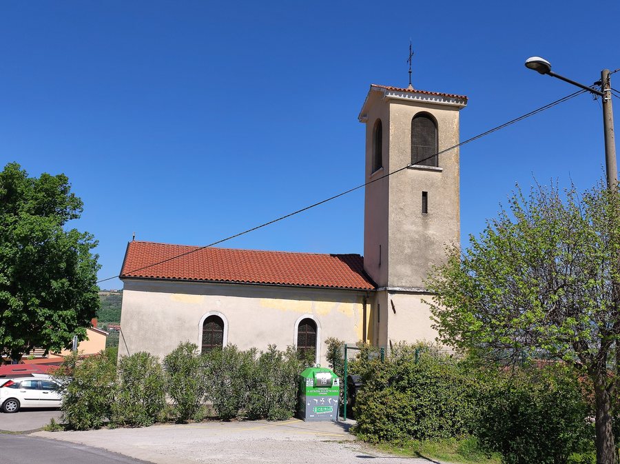 File:Zgornje Skofije, Christ the King church 01.jpg
Photo: Ajznponar via Wikimedia Commons, CC BY-SA 4.0
File:Zgornje Skofije, Christ the King church 01.jpg
Photo: Ajznponar via Wikimedia Commons, CC BY-SA 4.0
Zgornje Škofije stretches along the southwestern slope of Tinjan and is a settlement made up of three hamlets. The southwestern slope is considered somewhat sunnier and protected from the bora. From Slatine, there are wide views of Trieste, Koper and the Šavrin Hills.
How is Zgornje Škofije structured between the road, hamlets and village centres?
The three old village centres lie below Tinjanska cesta. This spatial relationship gives the settlement a clearly distinguishable structure: the village centres form the historical reference within the three hamlets, while the road lies above them.
Rather than a single centre, several hamlets take centre stage. The landscape around the three hamlets is characterised by vineyards and olive groves. These areas surround the settlement sections and connect them with the rural surroundings.
What landscape and views characterise the southwestern slope near Zgornje Škofije?
Together with the vineyards and olive groves, this creates a setting where open long-distance views exist alongside agriculturally shaped landscapes.
Which churches and architectural forms are there?
The Church of Christ the King stands in Zgornje Škofije. It was built between 1931 and 1935 and is a single-nave church with a rectangular presbytery.
A bell tower stands against the eastern wall of the Church of Christ the King. Its belfry has four semicircular openings. Zgornje Škofije also has a village chapel with a rectangular ground plan, a gabled roof and a semicircular entrance.
The church and village chapel differ in their architectural features: the church is single-nave and has a rectangular presbytery; the village chapel has a rectangular ground plan, a gabled roof and a semicircular entrance.
What historical traces can you find near Šanse?
Stone walls described as a “limes” were found near Šanse. Šanse is also considered the site of an earlier Roman fortification or observation post.
Which route connections are documented?
A short turn-off from Tinjanska cesta leads to the hamlet of Rombi. From the well in Druga Škofija, a path continues to the fields of Mandrija and Termun.
For planning your own route in the local area, the specific starting points are separate: the short turn-off to Rombi begins at Tinjanska cesta, while the path to the fields of Mandrija and Termun begins at the well in Druga Škofija.
What role does the wine road play?
A wine road runs through the area of Zgornje Škofije and continues to Elerje and through the Milje Hills. Its route therefore extends beyond the immediate local area.
For planning a wine-road route geographically, the route therefore extends beyond Zgornje Škofije and includes Elerje and the Milje Hills.
Further destinations: Hrastovlje, Babiči, Koper, Rižana, Boršt, Pobegi, Gradin and Krkavče.
To the higher-level travel overview: Koper.

