
Discover Čakanovce: Natural Monument and Educational Trail
Accommodation in Čakanovce
Čakanovce is located in the western part of the Cerová vrchovina, in the valley of a tributary of the Belina. The Čakanovský profil Natural Monument has been protected since 1990 and covers 0.69 hectares. The Čakanovský profil also includes a 1.3 km educational trail.
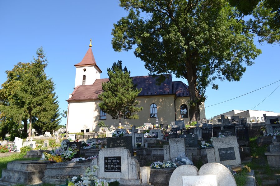 File:Čakanovce - Kostol sv. Alžbety (1).jpg
Photo: Ladislav Luppa via Wikimedia Commons, CC BY-SA 4.0
File:Čakanovce - Kostol sv. Alžbety (1).jpg
Photo: Ladislav Luppa via Wikimedia Commons, CC BY-SA 4.0
Nature
The Čakanovský profil shows sediments of a retreating sea from the Lower Miocene. Terrestrial lake and river sediments subsequently formed there. The upper part of the profile also contains a lignite seam formed in a swamp environment. Significant palaeontological finds at the Čakanovský profil include marine shells.
The landscape within the municipality is also clearly differentiated. It is largely deforested and ranges from hilly country to mountainous terrain. Preserved stands of oak and acacia are present. The geological bedrock consists of young Tertiary tuffaceous sandstones divided by erosion gullies. Eroded remnants of basalt and andesite emerge in places.
History
Čakanovce has been documented in writing since 1439 under the name Chakanbaza. During the wars of the 17th century, the settlement fell into decline and was restored as a noble settlement at the beginning of the 18th century. From 1554 to 1594, Čakanovce was occupied by the Turks and incorporated into the Sečany sanjak.
An archaeological site with a bronze hoard is recorded in the outlying area of the municipality of Čakanovce. The time span of the locally documented history thus extends from its written mention in the Middle Ages, through the conflicts of the early modern period, to an archaeological site within the municipality.
Buildings
The village is home to the Roman Catholic Baroque Church of Saint Elizabeth, dating from 1778. There is also a Classicist roadside chapel from the early 19th century. Both buildings are visible historical elements of Čakanovce and complement the natural-history themes of the Čakanovský profil with evidence of the settlement's and architectural history.
On Site
The Čakanovský profil can be reached from Čakanovce via a dirt track. The first sections—the lower sand pit, the road cut and the gravel pit—are well exposed. The surroundings of the Iboľa adit at the Čakanovský profil are different: this area is heavily overgrown and difficult to access.
Different terrain and exposure conditions therefore occur alongside one another along the profile. The 1.3 km educational trail, the sediments, the lignite seam and the marine shells are just as central as the specific condition of the individual sections.
Anyone comparing offers for Čakanovce can check the respective detail fields before booking. These include the exact location, the type of accommodation and the permitted occupancy. It is also clear which services are included in the price and which price components make up the total amount. For different travel plans, the conditions for booking, changing or cancelling also deserve attention. Comparing these fields helps clearly distinguish the costs and terms of individual offers. To do so, view the displayed hotel offers and compare the stated fields before making your decision.
Other Places
Open the following place pages if you would like to compare other destinations at the same navigation level: Gregorova Vieska, Lovinobaňa, Dobroč, Podrečany, Radzovce, Bulhary, Ľuboreč, Točnica.
To the higher-level travel overview: Lučenec District.

.jpg)